Natural Resources
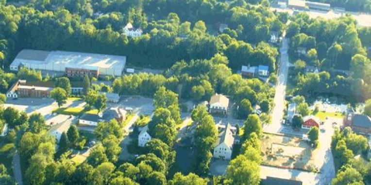
The Town of Antrim has a wealth of natural resources. Due to the hilly topography, most of Antrim is undeveloped. There are abundant conservation areas, hiking trails and waterways for recreation, wildlife habitat and preservation.
Hills and Mountains
The following is a list of the major elevation points in Antrim:
| Name | Elevation (Ft.) | Name | Elevation (Ft.) |
|---|---|---|---|
| Bald Mountain | 2,030 | Goodhue Hill | 1,620 |
| Gibson Mountain | 1,330 | Holt Hill | 1,370 |
| Riley Mountain | 1,440 | Meetinghouse Hill | 1,370 |
| Robb Mountain | 1,820 | Patten Hill | 1,390 |
| Willard Mountain | 1,920 | Tuttle Hill | 1,760 |
| Windsor Mountain | 1,450 |
Source: United States Geologic Survey
Water Resources
The Town of Antrim is gifted in the number and quality of its water resources. Antrim falls entirely within the Contoocook River Watershed, which is a part of the Merrimack River Basin. A watershed is an area in which all the land drains to a particular common point or body of water. There are four main watersheds in Antrim: the Contoocook River, the North Branch of the Contoocook River, Great Brook, and Cochran Brook. The Contoocook River flows approximately 70 miles from Poole Pond in Rindge north to Concord, where it flows into the Merrimack River with Antrim located approximately at its midpoint. All of Antrim’s surface water drainage eventually flows into the Contoocook River.
The North Branch is a major tributary of the Contoocook River and which flows northerly from Highland Lake in Stoddard to its confluence with the Contoocook River in Hillsboro, just north of the Antrim town line. Both of these rivers were placed in the New Hampshire Rivers Management and Protection Program in June 1991.
The following are a list of significant lakes and ponds in Antrim with a brief description of the recreational and other uses of each waterbody listed.
- Franklin Pierce Lake is approximately 519 acres in size. The southern third of the lake is in Antrim, while the main body and the Harriman Electric Power Dam are in the town of Hillsboro. It is a warm water fishery. Recreational uses include fishing, water skiing, boating, sailing, swimming and bird watching. There is, at present, limited public access in the town of Antrim to this lake.
- Gregg Lake is approximately 195 acres in size. It is a moderate warm water fishery. Recreational uses include fishing, picnicking, water skiing, boating, sailing, and bird watching. Public access is adjacent to the Antrim town beach, three miles from downtown Antrim.
- Willard Pond is approximately 96 acres in size. It is an excellent cold water fishery. It is part of the dePierrefeu-Willard Pond Wildlife Sanctuary. Fly fishing, hiking, and bird watching are the main recreational uses of the sanctuary. Public access is provided for boats, however, petroleum powered motors are prohibited. Access to Willard Pond is off of Route 123 in Hancock.
- Campbell Pond is approximately 17 acres in size. It is the former water supply and present back up water supply for Antrim. There is no road access to Campbell Pond.
- Lilly Pond is under 10 acres in size. Hiking and bird/wildlife watching are the main recreational uses of the pond. Public access is by foot trail through a series of formal and informal easements.
- Rye Pond is approximately 13 acres in size with portions of the pond in the towns of Antrim, Nelson, and Stoddard. It is a warm water fishery with limited public access.
- Steele’s Pond is approximately 36 acres in size. It provides the water source for a small hydro power plant, whose generated electricity is sold to Public Service of New Hampshire. There is no recreational activity at this Pond, other than some limited fishing off of the bridge, a short distance from Route 9.
In addition to these lakes and ponds, wetlands constitute about 2,475 acres (11%), out of Antrim's total land area of 23,125 acres. They are distributed fairly evenly around town, consisting primarily of small pockets or areas adjacent to streams. There are, however, a number of significant and large wetland areas in town. Some of these wetlands are listed here, but this list is not all inclusive: Meadow Marsh, Cochran Swamp, Great Cedar Swamp, Liberty Farm Swamp, Salmon Brook Swamp, and bottom land areas adjacent to the drainage in town (i.e. including but not limited to the Contoocook River, Great Brook and the North Branch).
Trails & Protected Land
- Lily Pond, Ziegler/Hurlin Trail –is a trail system starts at the Meetinghouse Hill cemetery and wends its way down the southern flank of the Meetinghouse Hill. From the trailhead on Route 31, it continues across the highway and out the rear of the old Center cemetery. From the Center Cemetery, the trail travels along a deeded trail easement along the stone wall. The trail formally terminates at the Lily Pond. Land around the pond as well as at the rear of the Meetinghouse Cemetery are privately owned and the land should be treated with the utmost of respect and care. The overall trail length is approximately 4,500 feet, with Route 31 transecting the trail at the halfway point.
- McCabe Forest Trail is a trail system cared for by the Society for the Protection of New Hampshire Forests (SPNHF). It is a two-mile trail loop that leaves the parking lot off Route 202 and loops through the 192-acre McCabe Forest to the Contoocook River and back.
- DePierrefue-Willard Pond Wildlife Sanctuary (Bald Mountain) Trail System is a sanctuary and trail system maintained by the New Hampshire Audubon Society. The 1,000+-acre sanctuary is the largest New Hampshire Audubon property, and along with additional easements, gifts and protected lands brings the protected lands around Willard Pond to more than 2,000 acres. Willard Pond is about 100 acres is size and is surrounded by Bald Mountain and Goodhue Hill. There are four substantial trails in the system, two of which go to the summits of Bald Mountain and Goodhue Hill. DePierrefue-Willard Pond Wildlife Sanctuary Trail System Map
- Loverns Mill Cedar Swamp Preserve is a 613 acre conservation project cooperatively developed and maintained by the Nature Conservancy and SPNHF. The preserve is located along Route 9 in an undeveloped section of North Branch. It contains several trails which transect portions of the property and leads to the nearly 50 acre boreal, cedar swamp. Nature conservation partners have connected the preserve to a larger conservation project. This larger project is to include the 5,000 acre SPNHF owned Peirce Reservation (in Stoddard and Windsor) and the Nature Conservancy’s 1693 acre Otter Brook Preserve.
- Meadow Marsh is a short trail (approximately 0.5 miles) on Town property along the wetland areas at the north end of Gregg Lake on either side of Craig Road at the intersection of the former Hattie Brown Road.
Important Timberlands
Much of Antrim’s landscape is heavily wooded. A large portion of this is located in the Rural and Rural Conservation Zoning Districts of town. These two districts occupy over 70% of Antrim’s land mass. There are hundreds of undeveloped acres in Town under single title ownership. These woodlands are viewed as a renewable resource and are logged on a regular basis. A typical woodlot cut frequency is between 25 and 50 years.
Timber harvesting, if proper erosion control management practices are not utilized, can expose soils to severe erosion. Severe erosion can occur during the construction of skid roads, haul roads, landings, and the cutting of timber on steep slopes. Without proper erosion control mechanisms in place, severe soil erosion may also cause harmful and unlawful sedimentation of wetlands and water bodies, negatively impacting aquatic life by adding nutrient and sediment loads to nearby water bodies.
Significant Wildlife Areas
While it could be stated that much of Antrim is a habitat for wildlife, certain areas stand out for the abundance and diversity of wildlife present. A brief listing of wildlife to be found in Antrim include:
Deer, moose, black bear, muskrat, woodchuck, porcupine, beaver, squirrel, chipmunk, mink, fisher, otter, skunk, weasel, raccoon, red fox, coyote, and a wide variety of snakes, frogs, birds, and fishes.
The Rural and Rural Conservation Districts are the districts that have been identified by their nature to be home to these creatures. This is not to say that these wildlife are not found in the other districts, because they are, but that in the two rural districts they can inhabit the ecological niche (habitats) they require.
The more diverse the wildlife species, the greater the need for diverse habitats. Some species require only small areas – less than an acre. Others need hundreds (or even thousands) of acres and some require a mix of different habitat types throughout the year. A diverse habitat is one that consists of a variety of landforms and vegetative cover, for example: open fields, woods, streams, marshes, ridges, and valleys. Significant habitats will typically be connected by migratory routes or wildlife corridors. Frequently, these are found along stream and river paths, ridgelines, large tracts of undeveloped woodlands, etc.


